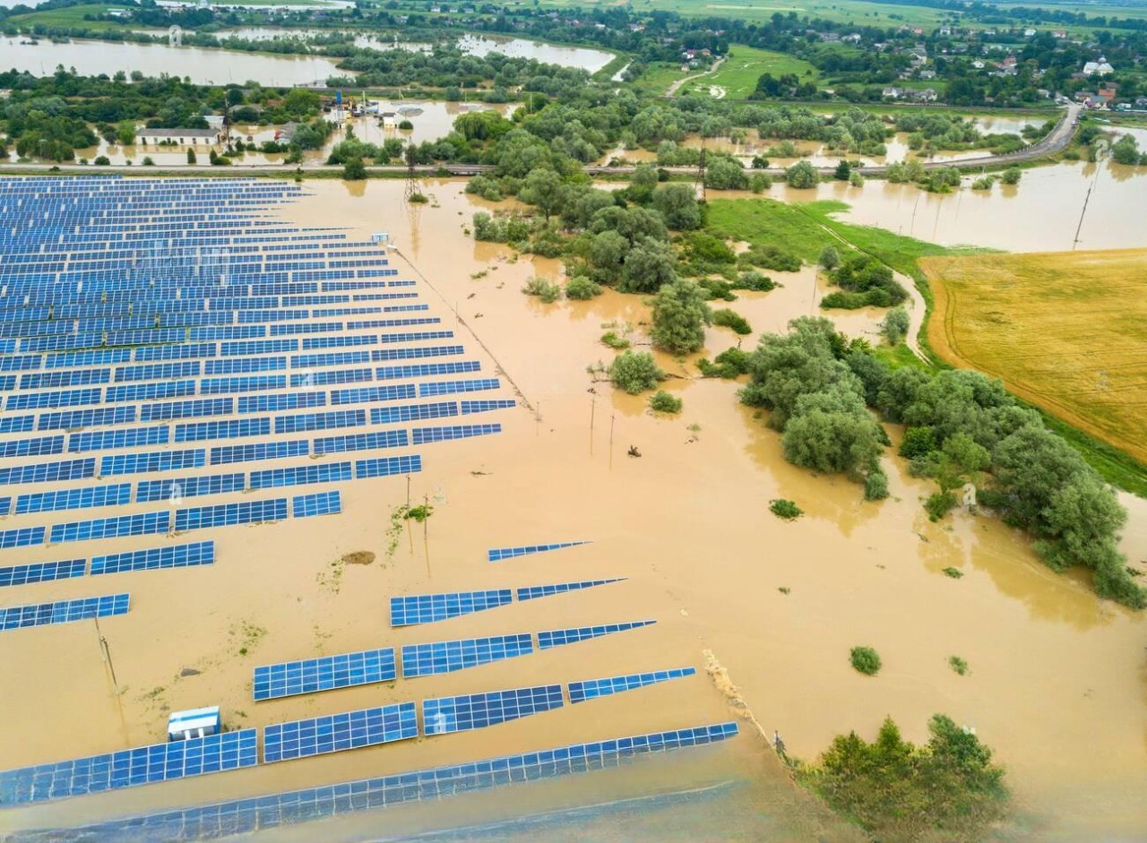
Our perspective for installing solar power plants is future security and nature’s stability while maintaining its beauty, but due to the destruction of nature so far, the seasons have become unpredictable, and natural calamities which are called “Natural” but actually are caused by humans. Landslides, earthquakes, and heavy rainfall cause flood-like situations which affect lives and infrastructure. Indeed, it is a fact that we can no longer foresee what might happen next after the flood incident in Dubai; this should be our lesson that climate change cannot be underrated. Therefore, site selection and effective drainage systems in ground-based solar power plants play a crucial role in optimizing energy production as well as mitigating floods.
How Flooding Affects Solar Power Plants
Solar power plants are not immune to climatic changes. There are direct and indirect effects associated with flooding on such facilities.
1. Direct Damages
Flooding can immediately damage solar panels, inverters, and electric systems. Water intrusion causes short circuits, corrodes equipment, or causes them to fail, thus leading to downtime that is costly to repair. For instance, during severe weather events, solar installations in flood-prone areas may become inoperable, leading to energy shortages and financial losses for operators.
2. Indirect Damages
Flooding also affects the supply chain for solar power plants. If roads are flooded, transportation will be hindered, delaying the delivery of important maintenance components. Additionally, it impacts the financial viability of solar projects. As communities recover from flooding, energy consumption patterns may shift, complicating energy management strategies for solar operators.
Key Considerations Towards Mitigating Flood Risks for Ground-Mounted Solar Power Plants
Site selection and flood risk assessment are essential while planning for ground-based solar power plants. Thisguarantees that the sites chosen are suitable not only for solar energy production but also can withstand probable flooding incidences. Here’s an overview of how these aspects can be effectively integrated: (Site Selection & Key Considerations)
1. Topography and Drainage

Screenshot
For drainage patterns, water flow is determined by the shape of the land at the location. Areas with flat or gentle slopes are preferred to minimize runoff and reduce potential flooding. Knowledge of natural drainage characteristics is vital during site selection.
2. Proximity to Water Bodies

Sites located near rivers or lakes may face higher flood risks. Analyzing historical records on flooding and floodplain maps helps assess the probability of floods during extreme weather conditions.
3. Soil Characteristics
Soil permeability determines both water absorption and runoff capabilities. Geotechnical assessment helps ascertain soil capacity for stormwater management, thus reducing the chances of floods.
4. Existing Infrastructure
Existing drainage systems’ capacities and state of repair and maintenance should be evaluated. Poorly maintained drains worsen the chances of flooding, making neighboring infrastructure necessary in relation to site selection.
Also read: The Importance Of Site Survey Data In Solar Project
Implement Effective Drainage Systems
1. Design Drainage Solutions

Design comprehensive approaches that remove water from solar plants like swales and retention basins and correct grading aimed at managing storm waters appropriately.
2. Regular Maintenance
Inspect the drainage systems often. They can become blocked easily, creating problems, especially during heavy downpours.
For site selection and hydrological modeling, these tools and organizations provide valuable benefits:
1. Vulnerability Atlas of India
This tool contains data on flood risk and detailed maps of different regions across India, which will facilitate decisions on site selection and the planning of future hydrological models.
Using this atlas, planners can identify flood-prone areas and choose places with low flooding risk for siting solar PV plants.
2. Esri India
Provides GIS tools that help analyze geographic data. Use Esri’s software to overlay flood risk maps on potential solar plant locations so that you can evaluate and select the safest sites.
3. FEMA (Federal Emergency Management Agency)
Although FEMA is a US agency, its methodologies and tools for assessing flood risk may provide insights into flood modeling techniques and strategies for managing risks associated with floods. These methods can be adapted to Indian contexts to evaluate and mitigate flood risks.
4. OpenFlows FLOOD
This software facilitates the detailed creation of flood models. Engineers could simulate virtual floods around solar PV sites by applying OpenFlows FLOOD to develop necessary adjustment measures, such as elevated foundations or drainage arrangements, to protect solar infrastructure.
Conclusion
In conclusion, it is evident that flooding poses significant challenges to ground-mounted solar power plants. Direct and indirect damages can lead to downtime, financial losses, and supply chain disruptions. To mitigate flood risks, careful site selection, effective drainage systems, and regular maintenance are crucial.
Leveraging solar designing tools such as the Vulnerability Atlas of India, Esri India, FEMA, and OpenFlows FLOOD can aid in flood risk assessment and the planning of future hydrological models. By integrating these considerations and tools, we can enhance the resilience of solar power plants against the impacts of flooding and contribute to sustainable energy production in the face of climate change.
We at Heaven Designs Private Limited offers entire end-to-end solution for site selection. we provide hydrology report. feel free to share your ground mount solar design requirements on Email or WhatsApp.


